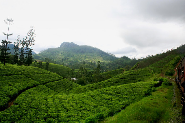
 It is located on the southeast of Kandy,
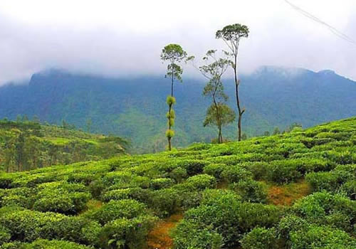
almost encircled by the Badulu Oya River, about 680 metres (2200 ft) above sea
level and is surrounded by tea plantations. The town is overshadowed by the
Namunukula range of mountains (highest peak 2,016 meters above sea level). It
was the base of Sinhalese princes who ruled the area under the king in Kandy
before it became part of the British Empire. Later, it became the
administrative hub of the British rulers. The city was the end point of
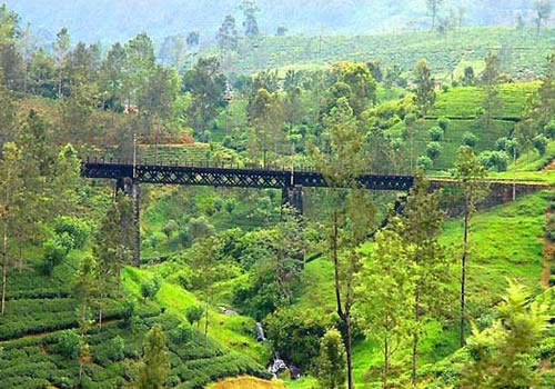
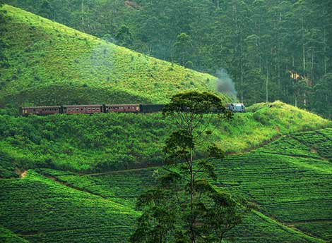
upcountry railway line built by the British in order to take plantation
products to Colombo.
It is located on the southeast of Kandy,
almost encircled by the Badulu Oya River, about 680 metres (2200 ft) above sea
level and is surrounded by tea plantations. The town is overshadowed by the
Namunukula range of mountains (highest peak 2,016 meters above sea level). It
was the base of Sinhalese princes who ruled the area under the king in Kandy
before it became part of the British Empire. Later, it became the
administrative hub of the British rulers. The city was the end point of
upcountry railway line built by the British in order to take plantation
products to Colombo.
Badulla is about 230km away from Colombo
towards the eastern slopes of central hills of Sri Lanka. There are
 Multiple routes to Badulla from Colombo,
Kandy and Galle. From Colombo, one can travel via Ratnapura, Balangoda,
Haputale, Bandarawela and HaliElaalong A4 and A16 to Badulla which may take
about 5-6 hours. From Kandy there are two routes. Either via
"Victoria-Randenigala Raja Mawatha" or viaNuwara Eliya (route A5).
From Galle, the best route is via Marata,Hambantota, Wellawaya, Ella, Demodara
and HaliEla (route A2). All routes are scenic and one can get splendid views of
geography changes while travelling. Badulla and surroundings are highly
recommended for eco-tourists as Horton Plains National Park and the Knuckles
mountains are few hours away.
Multiple routes to Badulla from Colombo,
Kandy and Galle. From Colombo, one can travel via Ratnapura, Balangoda,
Haputale, Bandarawela and HaliElaalong A4 and A16 to Badulla which may take
about 5-6 hours. From Kandy there are two routes. Either via
"Victoria-Randenigala Raja Mawatha" or viaNuwara Eliya (route A5).
From Galle, the best route is via Marata,Hambantota, Wellawaya, Ella, Demodara
and HaliEla (route A2). All routes are scenic and one can get splendid views of
geography changes while travelling. Badulla and surroundings are highly
recommended for eco-tourists as Horton Plains National Park and the Knuckles
mountains are few hours away.


No comments:
Post a Comment